A vision for how Bradford could use drone technology

Photo: Jason Andrews
Why we are talking about the future of drones in Bradford
Bradford has pressing needs which drones can help fulfill
Bradford Metropolitan District is the fourth largest of its kind in the UK, and encompasses a range of landscapes that include dense urban areas as well as forest, farmland and moorland. It is home to a diverse population of over 500,000 people with roots all over the world. Bradford was one of the hubs of the Industrial Revolution, and has an accompanying history of innovation and manufacturing. The legacy of this time is over 2,000 listed buildings and a UNESCO World Heritage Site in Saltaire.
Today the district faces a range of challenges and opportunities. Bradford is the youngest city in the UK, but is below the national average in terms of skills, employment and wages, an economic challenge resulting from the transition to a post-industrial economy. A key goal for the city, as outlined in the District Plan 2016-2020, is to attract high-skilled jobs and inward investment and to improve educational attainment and job opportunities. The region is also growing in population, leading to an increased demand for good quality and affordable housing. At the same time, the district has a number of historic buildings lying empty in need of investment and redevelopment. The growing population, accompanied by demographic changes, has meant increased demand for social services, including health and social care. Improving health outcomes is thus an important priority for the region. This is occurring against a backdrop of financial constraints across all public services, requiring innovative approaches across the public sector.
In a survey with Bradford Council’s people’s panel, 84 percent of respondents believed that drones would carry out a variety of important functions in the future and 63 percent supported Bradford being a testbed for drone applications.
A growing focus on the digital sector
Drones can align with the city’s digital strategy
Bradford Council is about to launch a digital strategy, which sets out the use of digital technology for smart city management, economic growth and connected communities, and discusses the need for building digital skills in the local workforce, convening different stakeholders and infrastructure development using digital technology. Drones can be a part of all of these objectives. Bradford has local digital sector strengths that can interface with the use of drones, including three internet of things (IoT) networks and a digital health enterprise zone. Further, the district aims to position itself as a testbed for emerging technologies, and Bradford Council and the University of Bradford are participating in the experimental European Commission-funded Smart City and Open Date Re-use (SCORE) programme. The development of testbeds for emerging technology can provide learnings for the local authority and enhance its growing reputation as a centre for innovation that can attract inwards investment and high skilled jobs.
There are a number of commercial drone operators locally. Yorkshire Water have their own dedicated UAV team, and drone trials have already begun within the local West Yorkshire Police and West Yorkshire Fire and Rescue Service, creating a growing foundation of expertise. Bradford also has a strong, globally networked drone hobbyist community. The region is highly connected with neighbouring Leeds, where the University of Leeds has advanced specialism in robotics, and hosts the Self Repairing Cities project that includes the use of autonomous drones for diagnosis and repair of city infrastructure. Bradford is also a founding member of the Leeds-based Open Data Institute, an organisation set up to promote innovation at the city level based on the use of open data.
There is evidence of popular support for some uses of drones in the district. In a survey with Bradford Council’s people’s panel, 84 percent of respondents believed that drones would carry out a variety of important functions in the future and 63 percent supported Bradford being a testbed for drone applications (27 percent opposed and 10 percent undecided).
Drones can develop skills, support city development and improve the efficiency of public services
A vehicle for better skills and jobs, particularly through promoting STEM education, attracting high-tech companies and inward investment
By pioneering drone applications through early adoption and testbeds, Bradford can attract more high-tech businesses to the region and create more high-skilled jobs to deliver and support drone services. In addition to attracting more high-skilled workers from outside, there is also an opportunity to use drones to inspire young people to pursue STEM subjects and improve skills in the district. This could be through a bespoke programme or one-off events in schools or community institutions such as the National Science and Media Museum.
Drones as a data source
Drone data could integrate with other digital technology (3D modelling, IoT, GIS, VR/AR, AI), to support initiatives within planning, surveying, regeneration and smart cities
As cities get smarter, drones can be used to provide better information to government, the blue light services, businesses and individuals. Combined with an array of sensors, drones can capture valuable data that would be prohibitively expensive or impossible to capture by other means. Bradford is interested in how this can contribute to understanding of the city, in both the near and long term, tying in with local digital initiatives such as SCORE and Things Network Leeds-Bradford.
Drone data is even more valuable when combined with other digital technologies for example capturing photos to be processed into 3D digital models that can then be used to support planning or even dynamically manage the city by feeding in sensor and IoT data, such as the five IoT sensors that have been installed to detect flooding in Bradford Beck. Artificial intelligence tools such as machine learning can be applied to drone data, and the University of Bradford is currently investigating how this could be used to identify features on 3D models captured by drones. This could be applied to identify particular features of the city and changes over time, automatically assessing deterioration of infrastructure, progress in construction or long-term changes such as the impact of climate change on wildlife. Drones can also interact with virtual reality to create fly throughs and interactive videos, which could provide a strong advert to developers for the Bradford’s many historic buildings, many of which are currently under-utilised.
Increased efficiency of public services
Drones could streamline crucial services such as surveying and inspection
Drones could streamline and reduce the cost of public services in Bradford. This could be through faster response to emergency incidents, more effective community safety and increased efficiency of local authority surveying and inspections. In the future these types of services are envisioned as being fully automated, saving time and money and removing people from physically demanding and dangerous work. Future uses could extend beyond data capture and include transporting time-critical goods such as medical or emergency supplies, linking hospitals in different parts of the city, or even to automating interventions such as repairs to urban infrastructure.
What should guide drone policy development in Bradford?

Public consent is key
Drones must only be rolled out with public consent - and consent is contingent on protecting the public. Future public decision-making or policy development governing drone use in Bradford should take these principles into account.
Recommended principles to guide future drone development in Bradford
Drone development in Bradford should tackle inequality, protect privacy and civil liberties and only be introduced where there is public support for a clear benefit
- Inclusivity. A core pillar of Bradford’s digital strategy is that digital technology should be used to help tackle inequality and not exacerbate it. This includes making digital technologies widely accessible and facilitating open and free at point of delivery digital services. Some drone applications, particularly logistics and passenger transport, could widen inequalities, for example by being premium services that are only accessible to those who can afford them, or by replacing jobs (e.g. couriers). Bradford stakeholders believe the benefits of drone technology should be widely shared and that inclusivity should be a key factor in future drone integration policy.
- Maintaining privacy and civil liberties. Clear guidance around privacy and drone use will be paramount. It should be easy to find out what type of information drones are collecting, and operators should follow GDPR guidelines. Citizens need to know how their data is going to be used, where it’s going to be stored and for how long. Drones should only collect data that is relevant for their operation and if possible use privacy-by-design features so that inappropriate data cannot physically be collected.
- Justification for use of drones. Bradford seeks to see a clear public benefit to justify the use of drones if they are to be deployed in the district at any significant scale. The social and economic impact of using drones for new and disruptive tasks should be understood, and it should be clear why a drone is the most effective solution as opposed to another approach, considering the benefits and disbenefits. The impact should consider time and cost savings, health and safety benefits, effect on jobs, and impact on the environmental and local quality of life. Testbeds and trials would be one method to help understand some of this potential impact. Once a clear argument for novel or public-service use of drones has been established, it should be communicated effectively to the local community.
- Public engagement. Bradford believes there should be a mechanism to inform citizens about drone use in the region and to enable the public to input into policy decisions around drone use. This should include relevant communication channels, clear information provided and mechanisms for people to provide feedback. This includes any drone operations conducted by or on behalf of the local authority and will be particularly important as drone technology becomes capable of operating with greater autonomy.
What could drones do in Bradford?
Support the emergency services and assist with city planning, maintenance and regeneration
Based on local stakeholders’ review of Bradford’s challenges, the activities that drones could perform, and the principles that should guide their usage, the following activities represent the greatest opportunities for Bradford.
Supporting the emergency services with response and prevention
Emergency services are the most trusted to use drones responsibly
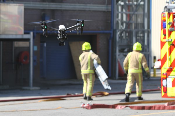
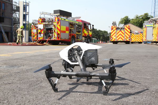
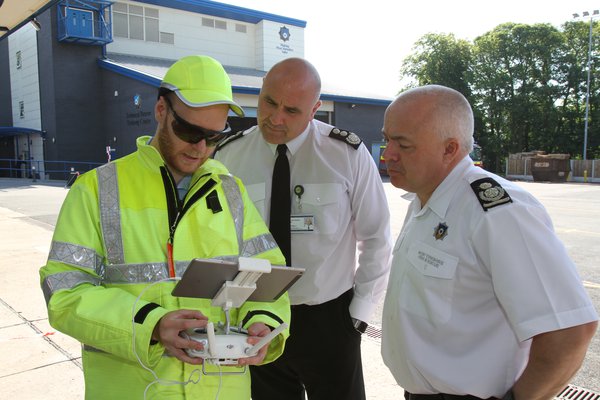
In a recent survey conducted with Bradford Council’s people’s panel, 98 percent of respondents supported the use of drones by the fire and rescue service and 93 percent use by the police. Emergency services are also the most trusted to use drones responsibly (98 percent survey respondents trusted the fire and rescue service to use drones and 89 percent trusted the police). There is a clear public benefit that drones could provide in emergency scenarios. In risk prevention, drones can be used to capture data to understand the potential for, and plan a response to, disasters such as fires and floods. Drones could also be used in response to an incident to assess the situation in real time, understand dangers and locate missing persons (refer to the Flying High use case analysis of drones supporting the fire and rescue service for further detail). They could also be used in post-disaster management, helping to evaluate the extent of damage and provide intelligence to reconstruction efforts. It is important, however, that civil liberties are protected and that drones do not become an invasion of citizens’ privacy.
Improved city planning and management through use in surveying and mapping
Photography, 2D maps and 3D models
Aerial imagery can be a very useful tool for understanding what is going on in a city, in both short and long term. Drone photography can support the council with planning decisions, either in the form of simple photography or 2D maps or more sophisticated methods such as 3D models that are updated in real time with sensor data in the district.
Looking further to the future, drones could be used to automatically detect and even repair damage to infrastructure.
Streamlining government services to reduce costs of surveying / inspection and city maintenance
Roads, bridges, sewers, culverts and drains
One of the council’s functions is to manage and maintain local infrastructure, which involves a great deal of inspection work of assets such as roads, bridges, and sewers. Drones can provide a fast, safe and low-cost alternative to traditional means of inspection. Increasingly sophisticated data analytics can support this; for example, drones can automatically identify the condition of infrastructure and assess structural integrity. One specific opportunity for this in Bradford is the mapping of the district’s culverts and drains, which is difficult to carry out by traditional means. Looking further to the future, drones could be used to automatically detect and even repair damage to infrastructure, as is being investigated by the Self-Repairing Cities project at the University of Leeds.
Supporting city regeneration
By assisting with construction projects and using drones to film and advertise the city to tourists, skilled workers and investors
Drones can be used to promote the city of Bradford and support in regeneration of the district. This could be directly through increasing the efficiency of construction, an area where drones are already being used but where there is scope for further adoption and new opportunities as the technology evolves. Indirectly drones can be used to advertise the district. This could be through capturing aerial photography showcasing city attractions and natural beauty to visitors, or developing VR walk throughs and 360 degree videos where potential developers or residents can explore the district and its historic buildings.
Improving health outcomes through drones supporting medical logistics and response to medical emergencies
Speed up medical delivery between Bradford's six hospitals
Bradford has six hospitals in the Bradford Teaching Hospitals NHS Foundation Trust. Many of these hospitals are some distance from each other and have complex logistics networks between each other and with other sites. Many shipments, such as pathology samples, are time-critical. Drones for medical logistics could thus provide a substantial public health benefit as well as time and cost savings to the NHS, something Bradford views as a potential future opportunity to explore.
Demonstration and testbed opportunities

Bradford should create demonstration and testbed opportunities for 360 degree video, VR and 3D mapping
360 degree video and VR tour of regeneration sites
Bradford has a large number of vacant properties that are lying empty and in need of development, many of which are historic listed buildings. Drones can support regeneration of these properties through capturing the inside and outside of these buildings. This imagery can be used to create 360 degree videos and virtual reality tours of the sites, showcasing the potential to developers and the public.
This could be trialed in several locations. Two examples are Dalton Mills and North Parade. Dalton Mills was built in 1869 and was once the largest textile mill in the region. It has been partially restored with significant work needed to bring the rest of the building back to life. Many heritage mill buildings in the district have been lost to fire, with drones providing an opportunity to encourage regeneration.
The area around North Parade in the city centre, known locally as the ‘top of town’, has a cluster of empty historic listed buildings that are ripe for redevelopment and would benefit from the more detailed digital showcasing that drones could offer.
Creating 3D maps for planning and smart-city applications
Drones can be used to create an interactive digital 3D model of the district, or part of it, where other datasets can be overlaid, including real-time data from IoT sensors. The model can then be used to see changes to the city as they happen, helping to get a better understanding of the city. This can be used to understand real-time trends such as air quality or flood water levels, or medium-term trends such as changes to the built environment. Updating the model periodically with aerial drone footage can help to get a sense of much longer term changes, such as the impact of climate change or the spatial and landscape effects of particular investment or policy decisions.
One potential trial location for this application is Horton Park. A drone could capture imagery that could be processed into a photorealistic 3D model. IoT sensors to detect flood levels, air quality and other environmental factors could then be installed to give the local authority, and the community, an understanding of the local environment and be able to observe both real-time and long term environmental changes.
Recommended next steps for Bradford
Bradford should look to trial near-term uses for drones in the city
Over the coming year, Bradford should identify and assemble resources to further investigate and address the opportunities outlined in this vision, using the following outline of near-term actions as a roadmap:
- Identify and consider allocating funding for trials of drone services within the local authority of near term applications such as inspection, mapping and VR tours.
- Engage the public around drone use, disseminating examples of current use and supporting engagement around emerging uses by the police and fire and rescue service.
- Create an online platform to publicise drone work occurring in Bradford and benefits and learnings.
- Promote current drone legislation, including the drone code, to encourage safe use of drones.
- Incorporate drone technology into future smart city and digital strategy work, using drones as a data source and consideration of drone requirements for future digital infrastructure such as 5G.
- Identify locations for experimental drone applications.
- Identify industry and research partners that may be interested in working with the region to trial new drone applications that push the boundaries of what is currently possible.
- Continue to follow drone industry and regulatory developments and input to national policy debates around the future management of urban airspace and restricted areas.


